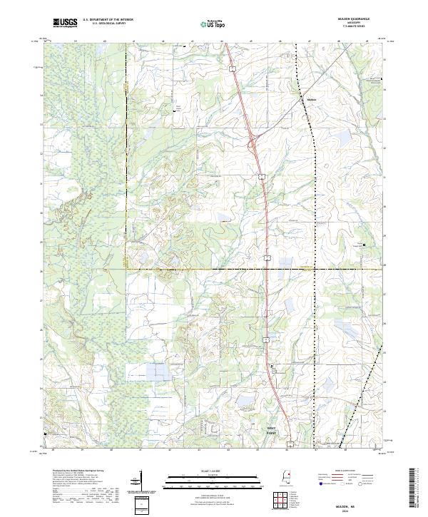
2024 Map of Muldon
USGS Topo · Published 2024About this map
The boundary between Clay and Monroe counties bisects this landscape, defined by a network of waterways including Houlka Creek, Johnson Bell Creek, and Chuquatonchee Creek. The settlement of Muldon sits at a crossroads in the northeast, while the northern edge of West Point anchors the southern portion of the map. This modern survey reveals a dense concentration of historical burial grounds that serve as touchstones for local genealogy, such as Le Noir Cem, Third Union Cem, and Siloam Cem.
Find a feature on this map
60 named features on this map. Tap any name to fly to it.
Don’t see what you’re looking for? This feature index may not catch every label — zoom into the map to look around manually.
Map Details
Editions of this 2024 Muldon Map
This is the sole edition of this map. No revisions or reprints were ever made.
Other maps of this area

1953 · West Point
USGS Topo · 1:250,000

1958 · West Point
USGS Topo · 1:250,000

1959 · West Point
USGS Topo · 1:62,500

1959 · Van Vleet
USGS Topo · 1:62,500

1959 · Pheba
USGS Topo · 1:62,500

1963 · West Point
USGS Topo · 1:250,000

1966 · Aberdeen
USGS Topo · 1:24,000

1966 · Prairie
USGS Topo · 1:24,000

1982 · West Point
USGS Topo · 1:100,000

1984 · West Point
USGS Topo · 1:250,000