
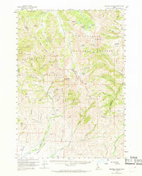
1960 Map of Muldoon Canyon
USGS Topo · Published 1961About this map
Muldoon (Site) serves as a focal point for this high-elevation mining landscape, where the extraction of ore shaped the settlement patterns of Blaine County. The map reveals a high concentration of silver and lead mining infrastructure, notably the Idaho Muldoon Mine and Mutual Mine, connected by a network of steep trails and gulches. The presence of Smelter Butte and the Logan Tunnel near the Muldoon Ridge provides evidence of the industrial processes that once dominated this section of the Sawtooth National Forest.
Find a feature on this map
102 named features on this map. Tap any name to fly to it.
Don’t see what you’re looking for? This feature index may not catch every label — zoom into the map to look around manually.
Map Details
Editions of this 1960 Muldoon Canyon Map
3 editions found
Other maps of this area

1895 · Hailey
USGS Topo · 1:125,000

1897 · Hailey
USGS Topo · 1:125,000

1935 · MacKay
USGS Topo · 1:96,000

1940 · Mackay
USGS Topo · 1:62,500

1955 · Idaho Falls
USGS Topo · 1:250,000

1955 · Hailey
USGS Topo · 1:250,000

1958 · Idaho Falls
USGS Topo · 1:250,000

1959 · Hailey
USGS Topo · 1:250,000

1960 · Grouse
USGS Topo · 1:62,500

1960 · Mackay
USGS Topo · 1:62,500