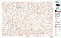
1985 Map of Mullen
USGS Topo · Published 1994About this map
The Nebraska Sandhills dominate this mid-1980s landscape, characterized by a complex network of wetlands and valleys that historically defined life in the region. The map tracks the vital east-west corridor of the Burlington Northern railroad, which serves a string of ranching communities including Ashby, Hyannis, Whitman, Hecla, and Mullen. This rail line mirrors the natural depressions of Ideal Valley and Brown Valley, illustrating how early transportation relied on the flat corridors between the dunes.
Find a feature on this map
43 named features on this map. Tap any name to fly to it.
Don’t see what you’re looking for? This feature index may not catch every label — zoom into the map to look around manually.
Map Details
Editions of this 1985 Mullen Map
2 editions found

Other maps of this area

1947 · Dismal River Ranch
USGS Topo · 1:62,500

1948 · Seneca
USGS Topo · 1:62,500

1948 · Ashby
USGS Topo · 1:62,500

1948 · Bingham
USGS Topo · 1:62,500

1948 · Carr Lake
USGS Topo · 1:62,500

1948 · Mullen
USGS Topo · 1:62,500

1948 · Spade Ranch
USGS Topo · 1:62,500

1948 · George Lake
USGS Topo · 1:62,500

1948 · Whitman
USGS Topo · 1:62,500

1948 · Spring Valley
USGS Topo · 1:62,500