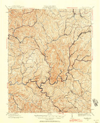
1925 Map of Mullens
USGS Topo · Published 1958About this map
Guyandot River and its numerous tributaries carve a complex landscape across this 1925 revision of the Wyoming and Raleigh County borderlands. The era's coal-driven economy is evident through the path of the Virginian Railway, which snakes through narrow valleys to serve industrial hubs like Mullens, Tralee, and Itmann. The presence of a Tipple and named settlements such as Stotesbury and Glen Rogers indicates a region deeply tied to mineral extraction and rail transport. Away from the industrial corridors, the ridges remain dotted with local landmarks like Hickory Knob and several community institutions, including Taliaferro School and Bowyer School. The topographic detail reveals a network of mountain passes such as Polk Gap and Station Gap that once served as vital links between isolated valley communities before modern highway development reshaped the West Virginia highlands.
Find a feature on this map
103 named features on this map. Tap any name to fly to it.
Don’t see what you’re looking for? This feature index may not catch every label — zoom into the map to look around manually.
Map Details
Editions of this 1925 Mullens Map
2 editions found
Other maps of this area

1887 · Pocahontas
USGS Topo · 1:125,000

1891 · Tazewell
USGS Topo · 1:125,000

1891 · Pocahontas
USGS Topo · 1:125,000

1891 · Oceana
USGS Topo · 1:125,000

1891 · Raleigh
USGS Topo · 1:125,000

1893 · Oceana
USGS Topo · 1:125,000

1894 · Pocahontas
USGS Topo · 1:125,000

1895 · Tazewell
USGS Topo · 1:125,000

1895 · Pocahontas
USGS Topo · 1:125,000

1897 · Tazewell
USGS Topo · 1:125,000