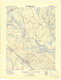
1919 Map of Mullica
USGS Topo · Published 1921About this map
Mullica River and its complex network of tributaries anchor this early 20th-century landscape, where the iron-working and bog-iron heritage of the New Jersey Pine Barrens is still clearly visible. Industrial and agricultural sites like Batsto and Pleasant Mills occupy the confluence of the Batsto River and Nescochague Creek, while the presence of Friendship Bogs and Tranquility Bogs to the northeast highlights the region's cranberry and blueberry cultivation history. The southeastern portion of the map shows the transition toward more established settlements like Egg Harbor and Germania, organized along the Pennsylvania Railroad.
Find a feature on this map
81 named features on this map. Tap any name to fly to it.
Don’t see what you’re looking for? This feature index may not catch every label — zoom into the map to look around manually.
Map Details
Editions of this 1919 Mullica Map
This is the sole edition of this map. No revisions or reprints were ever made.
Other maps of this area

1884 · Whitings
USGS Topo · 1:62,500

1887 · Atlantic City
USGS Topo · 1:62,500

1888 · Pemberton
USGS Topo · 1:62,500

1888 · Little Egg Harbor
USGS Topo · 1:62,500

1888 · Mount Holly
USGS Topo · 1:62,500

1888 · Whitings
USGS Topo · 1:62,500

1890 · Great Egg Harbor
USGS Topo · 1:62,500

1890 · Hammonton
USGS Topo · 1:62,500

1890 · Tuckahoe
USGS Topo · 1:62,500

1890 · Mullica
USGS Topo · 1:62,500