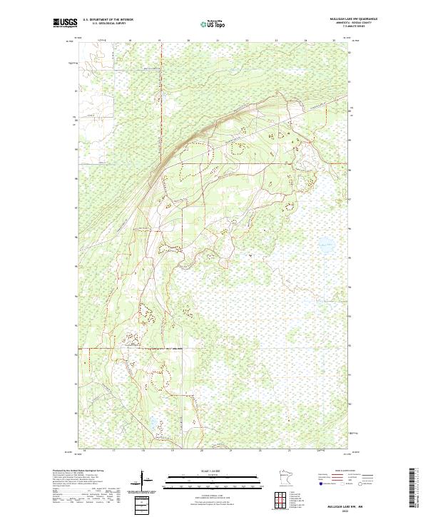
2022 Map of Mulligan Lake NW
USGS Topo · Published 2022About this map
The northern reaches of Minnesota's Beltrami Island State Forest define this landscape, characterized by a complex network of wetlands and managed timberlands. Much of the terrain is crisscrossed by specialized access routes such as Bemis Hill Forest Rd and Thompson Forest Rd, reflecting the region's focus on forestry and outdoor recreation. The presence of Mud Lake and surrounding marshes underscores the hydrologic nature of Roseau County, where seasonal water levels dictate the accessibility of the land.
Find a feature on this map
17 named features on this map. Tap any name to fly to it.
Don’t see what you’re looking for? This feature index may not catch every label — zoom into the map to look around manually.
Map Details
Editions of this 2022 Mulligan Lake NW Map
This is the sole edition of this map. No revisions or reprints were ever made.
Other maps of this area

1918 · Goos
USGS Topo · 1:62,500

1918 · Pencer
USGS Topo · 1:62,500

1918 · Warroad
USGS Topo · 1:62,500

1943 · Goos
USGS Topo · 1:62,500

1943 · Warroad
USGS Topo · 1:62,500

1954 · Roseau
USGS Topo · 1:250,000

1957 · Roseau
USGS Topo · 1:250,000

1958 · Roseau
USGS Topo · 1:250,000
1966 · Salol
USGS Topo · 1:24,000
1967 · Warroad SE
USGS Topo · 1:24,000