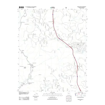
2011 Map of Munds Park
USGS Topo · Published 2011About this map
Oak Creek Canyon cuts a deep path through this Coconino County landscape, where the settlement of Indian Gardens sits at the base of the towering Wilson Mountain. This 2011 survey illustrates the transition from the steep canyon walls and points like Thompsons Point to the high plateau country surrounding Munds Park. The map documents a diverse array of water management features, specifically an extensive network of stock tanks including Telephone Tank and Coyote Park Tank, which suggest the area's continued reliance on seasonal water catchments for livestock and wildlife.
Find a feature on this map
84 named features on this map. Tap any name to fly to it.
Don’t see what you’re looking for? This feature index may not catch every label — zoom into the map to look around manually.
Map Details
Editions of this 2011 Munds Park Map
This is the sole edition of this map. No revisions or reprints were ever made.
Other maps of this area

1886 · San Francisco Mtns
USGS Topo · 1:250,000

1887 · Verde
USGS Topo · 1:250,000

1891 · San Francisco Mtns
USGS Topo · 1:250,000

1892 · Verde
USGS Topo · 1:250,000

1894 · San Francisco Mtns
USGS Topo · 1:250,000

1899 · San Francisco Mtns
USGS Topo · 1:250,000

1908 · Flagstaff
USGS Topo · 1:125,000

1912 · Flagstaff
USGS Topo · 1:125,000

1923 · Camp Verde
USGS Topo · 1:125,000

1932 · Camp Verde
USGS Topo · 1:125,000