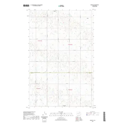
2020 Map of Munich SE
USGS Topo · Published 2020About this map
Alsen serves as the primary settlement within this northern prairie landscape, situated near the intersection of the county line and a network of section-line roads. The terrain is defined by the winding course of Starkweather Coulee, which meanders through both the northern and southern portions of the quadrangle. This area of North Dakota is marked by a distinctive glaciated topography, featuring numerous small, scattered wetlands and depressions that dot the agricultural fields. The map documents the precise boundary between Cavalier Co and Ramsey Co, followed closely by the Cavalier-Ramsey Co Line Rd. This survey reflects the enduring grid-based land management system of the American Midwest, where local travel is facilitated by numeric corridors such as 83rd St NE and 75th St NE.
Find a feature on this map
17 named features on this map. Tap any name to fly to it.
Don’t see what you’re looking for? This feature index may not catch every label — zoom into the map to look around manually.
Map Details
Editions of this 2020 Munich SE Map
This is the sole edition of this map. No revisions or reprints were ever made.
Other maps of this area

1953 · Devils Lake
USGS Topo · 1:250,000

1956 · Devils Lake
USGS Topo · 1:250,000

1962 · Starkweather
USGS Topo · 1:24,000

1962 · Starkweather NE
USGS Topo · 1:24,000

1970 · Alsen
USGS Topo · 1:24,000

1970 · Hampden
USGS Topo · 1:24,000

1970 · Munich
USGS Topo · 1:24,000

1971 · Calio
USGS Topo · 1:24,000

1971 · Munich SW
USGS Topo · 1:24,000

1971 · Munich SE
USGS Topo · 1:24,000