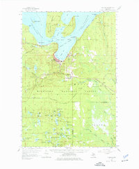
1958 Map of Munising
USGS Topo · Published 1977About this map
The Lake Superior coastline at Munising defines this mid-century survey, showcasing a landscape shaped by timber, tourism, and lake navigation. Grand Island dominates the northern waters, protecting Grand Island Harbor and featuring Williams Landing and several Lighthouses. On the mainland, the city limits are clearly marked by the Munising City Boundary, while smaller settlements like Christmas, Indian Town, and Wetmore dot the surrounding forest.
Find a feature on this map
109 named features on this map. Tap any name to fly to it.
Don’t see what you’re looking for? This feature index may not catch every label — zoom into the map to look around manually.
Map Details
Editions of this 1958 Munising Map
Other maps of this area

1931 · Shingleton SW
USGS Topo · 1:31,680

1931 · Steuben NW
USGS Topo · 1:31,680

1931 · Skeels Lake NE
USGS Topo · 1:31,680

1931 · Munising SE
USGS Topo · 1:31,680

1958 · Corner Lake
USGS Topo · 1:62,500

1958 · Trenary
USGS Topo · 1:62,500

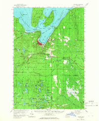
1958 · Munising
USGS Topo · 1:62,500

1958 · Au Train
USGS Topo · 1:62,500

1958 · Wood Island
USGS Topo · 1:62,500

1958 · Shingleton
USGS Topo · 1:62,500