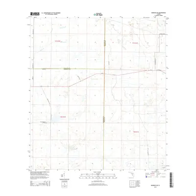
2015 Map of Murdock NE
USGS Topo · Published 2015About this map
Hydrological features like Big Slough Canal and Wildcat Slough define the drainage of this Southwest Florida landscape where the boundaries of Sarasota, Manatee, and DeSoto counties meet. The area is characterized by large agricultural and ranching holdings, evidenced by named thoroughfares such as Walton Ranch Rd and Longino Ranch Rd. These routes connect the open terrain to the primary east-west artery of Sr-72. The map also preserves traces of historical industry and local travel through names like Turpentine Still Rd and Tampensi Trl. In the northeastern corner, Buzzard Roost Br crosses a creek, marking a point of interest for local historians and genealogists tracking the development of these rural inland townships. The transition from natural sloughs to engineered drainage canals reflects the evolution of water management in the region.
Find a feature on this map
24 named features on this map. Tap any name to fly to it.
Don’t see what you’re looking for? This feature index may not catch every label — zoom into the map to look around manually.
Map Details
Editions of this 2015 Murdock NE Map
This is the sole edition of this map. No revisions or reprints were ever made.
Other maps of this area

1956 · Murdock
USGS Topo · 1:24,000

1956 · Myakka City
USGS Topo · 1:24,000

1956 · Edgeville
USGS Topo · 1:24,000

1956 · Murdock SE
USGS Topo · 1:24,000

1956 · Murdock NE
USGS Topo · 1:24,000

1956 · Limestone
USGS Topo · 1:24,000

1956 · Ft. Ogden
USGS Topo · 1:24,000

1956 · Nocatee
USGS Topo · 1:24,000

1956 · Murdock NW
USGS Topo · 1:24,000

1956 · Tampa
USGS Topo · 1:250,000