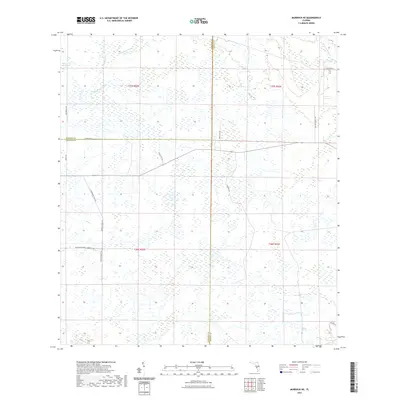
2021 Map of Murdock NE
USGS Topo · Published 2021About this map
Wetland drainages and expansive ranch lands dominate this part of Southwest Florida at the junction of Sarasota, Manatee, and DeSoto counties. This landscape is defined by the flow of water through systems like Wildcat Slough, Mud Slough, and the Big Slough Canal, which cut through a mosaic of sawgrass and scrub. Historically significant corridors like Turpentine Still Rd and Catface Ridge Rd hint at the region's past industries in naval stores and timber, where longleaf pines were once tapped for resin. Large-scale landholdings are represented by the Walton Ranch Rd and Longino Ranch Rd, maintaining the open character of the interior Florida peninsula. Remote tracks such as Sugarbowl Rd and Tampensi Trl provide access through the marshes and low-lying woods of the Messer Sawgrass region.
Find a feature on this map
26 named features on this map. Tap any name to fly to it.
Don’t see what you’re looking for? This feature index may not catch every label — zoom into the map to look around manually.
Map Details
Editions of this 2021 Murdock NE Map
This is the sole edition of this map. No revisions or reprints were ever made.
Other maps of this area

1956 · Murdock
USGS Topo · 1:24,000

1956 · Myakka City
USGS Topo · 1:24,000

1956 · Edgeville
USGS Topo · 1:24,000

1956 · Murdock SE
USGS Topo · 1:24,000

1956 · Murdock NE
USGS Topo · 1:24,000

1956 · Limestone
USGS Topo · 1:24,000

1956 · Ft. Ogden
USGS Topo · 1:24,000

1956 · Nocatee
USGS Topo · 1:24,000

1956 · Murdock NW
USGS Topo · 1:24,000

1956 · Tampa
USGS Topo · 1:250,000