
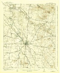
1916 Map of Murfreesboro
USGS Topo · Published 1916About this map
The Stone River Battlefield and the adjacent Stone River National Cemetery dominate the landscape northwest of Murfreesboro, marking the site of one of the Civil War's most significant engagements. This 1914 survey illustrates the region as a hub of early 20th-century transportation, where the Nashville Chattanooga and St Louis RR intersects with a radial network of historic turnpikes, including the Nashville Turnpike and Bradyville Turnpike.
Find a feature on this map
74 named features on this map. Tap any name to fly to it.
Don’t see what you’re looking for? This feature index may not catch every label — zoom into the map to look around manually.
Map Details
Editions of this 1916 Murfreesboro Map
2 editions found
Other maps of this area

1903 · Nashville
USGS Topo · 1:125,000

1908 · Woodbury
USGS Topo · 1:62,500

1913 · Hollow Springs
USGS Topo · 1:62,500

1932 · Hermitage
USGS Topo · 1:62,500

1936 · Webbs Jungle
USGS Topo · 1:24,000

1936 · Rover
USGS Topo · 1:24,000

1936 · Beech Grove
USGS Topo · 1:24,000

1936 · Fosterville
USGS Topo · 1:24,000

1942 · Statesville
USGS Topo · 1:100,000

1942 · Lebanon
USGS Topo · 1:100,000