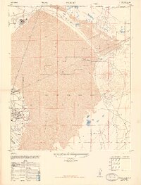
1947 Map of Muroc
USGS Topo · Published 1947About this map
Muroc Army Air Field dominates this postwar landscape in the Mojave Desert, revealing the early infrastructure of a site that would become central to American aerospace history. The installation is shown with detailed footprints for an airfield, a trailer park, and an NCO Club, while the vast, dry expanse of Rogers Lake provides the natural foundation for these operations. Bordering the military reservation, industrial activity is present at the Mojave Clay Corporation plant near Solon, connected by the Atchison Topeka and Santa Fe railroad. The map provides a unique look at the small civilian and support settlements like Muroc and East Camp before later expansions altered the local geography. Significant land use is further indicated by a rifle range and several clay pits, reflecting the transition from desert extraction to high-stakes defense testing during this era.
Find a feature on this map
26 named features on this map. Tap any name to fly to it.
Don’t see what you’re looking for? This feature index may not catch every label — zoom into the map to look around manually.
Map Details
Editions of this 1947 Muroc Map
This is the sole edition of this map. No revisions or reprints were ever made.
Other maps of this area

1915 · Searles Lake
USGS Topo · 1:250,000

1937 · Kramer
USGS Topo · 1:48,000

1937 · Rogers Lake
USGS Topo · 1:48,000

1942 · Kramer
USGS Topo · 1:62,500

1942 · Rogers Lake
USGS Topo · 1:62,500

1943 · Castle Butte
USGS Topo · 1:62,500

1947 · Fluhr
USGS Topo · 1:24,000

1947 · Castle Butte
USGS Topo · 1:50,000

1947 · Rich
USGS Topo · 1:24,000

1947 · Desert Butte
USGS Topo · 1:24,000