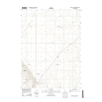
2013 Map of Murphy Hot Springs
USGS Topo · Published 2013About this map
Murphy Hot Springs sits at the southwestern edge of this high-desert plateau, where the E Fork Jarbidge River carves a deep canyon through the volcanic landscape. The settlement is supported by the small Murphy Hot Springs Airport and the nearby Wilkins Island, indicating the importance of remote access in this corner of Owyhee County. To the east, the terrain opens into the Big Flat and the edges of the Inside Desert, a vast expanse marked by isolated water sources like Poison Creek and Horse Lake.
Find a feature on this map
20 named features on this map. Tap any name to fly to it.
Don’t see what you’re looking for? This feature index may not catch every label — zoom into the map to look around manually.
Map Details
Editions of this 2013 Murphy Hot Springs Map
This is the sole edition of this map. No revisions or reprints were ever made.
Other maps of this area

1943 · Jarbidge
USGS Topo · 1:62,500

1945 · Jarbidge
USGS Topo · 1:62,500

1955 · Twin Falls
USGS Topo · 1:250,000

1955 · Wells
USGS Topo · 1:250,000

1957 · Elk Mountain
USGS Topo · 1:62,500

1958 · Wells
USGS Topo · 1:250,000

1958 · Twin Falls
USGS Topo · 1:250,000

1961 · Wells
USGS Topo · 1:250,000
1979 · Dishpan
USGS Topo · 1:24,000

1979 · Salls Crossing
USGS Topo · 1:24,000