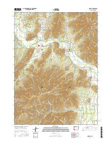
2017 Map of Murphy
USGS Topo · Published 2017About this map
Murphy and New Hope serve as the primary residential centers in this Josephine County landscape, where the Applegate River carves a path through the terrain. The presence of Murphy Ditch and the Murphy Bridge underscores the community's historical reliance on the river for irrigation and transport. Significant elevations like Pickett Mtn and Pennington Butte define the topography, while numerous reservoirs such as Lincoln Savage Reservoir and Tobiason Reservoir suggest a managed water system supporting local agriculture or industry.
Find a feature on this map
98 named features on this map. Tap any name to fly to it.
Don’t see what you’re looking for? This feature index may not catch every label — zoom into the map to look around manually.
Map Details
Editions of this 2017 Murphy Map
This is the sole edition of this map. No revisions or reprints were ever made.
Other maps of this area

1908 · Grants Pass
USGS Topo · 1:125,000

1954 · Oregon Caves
USGS Topo · 1:62,500

1954 · Gold Hill
USGS Topo · 1:62,500

1954 · Grants Pass
USGS Topo · 1:62,500

1954 · Ruch
USGS Topo · 1:62,500

1955 · Medford
USGS Topo · 1:250,000

1957 · Medford
USGS Topo · 1:250,000

1958 · Medford
USGS Topo · 1:250,000

1974 · Grants Pass NW
USGS Topo · 1:24,000
1974 · Grants Pass NE
USGS Topo · 1:24,000