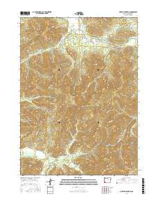
2017 Map of Murphy Mountain
USGS Topo · Published 2017About this map
The Applegate River cuts through this corner of Josephine County, defining a landscape of prominent peaks and deep gulches. Near the small settlement of New Hope, several local roads like Keen Rd and Fish Hatchery Rd provide access to the river valley, while the surrounding terrain is dominated by significant summits including Bolt Mtn and Eagle Mtn. In the southern portion of the sheet, the topography climbs toward Murphy Mountain and Mungers Butte, where the drainages transition to the Deer Creek watershed. This 2017 survey details the complex network of forest and resource management routes, such as BLM Rd 37-7-13 and Dryden Overlook Rd, which navigate the steep elevations between Rail Canyon and Packers Gulch. The map provides a clear record of modern property divisions and access roads within the Klamath Mountains transition.
Find a feature on this map
95 named features on this map. Tap any name to fly to it.
Don’t see what you’re looking for? This feature index may not catch every label — zoom into the map to look around manually.
Map Details
Editions of this 2017 Murphy Mountain Map
This is the sole edition of this map. No revisions or reprints were ever made.
Other maps of this area

1908 · Grants Pass
USGS Topo · 1:125,000

1917 · Kerby
USGS Topo · 1:125,000

1918 · Kerby
USGS Topo · 1:125,000

1945 · Kerby
USGS Topo · 1:125,000

1954 · Cave Junction
USGS Topo · 1:62,500

1954 · Oregon Caves
USGS Topo · 1:62,500

1954 · Selma
USGS Topo · 1:62,500

1954 · Grants Pass
USGS Topo · 1:62,500

1955 · Medford
USGS Topo · 1:250,000

1957 · Medford
USGS Topo · 1:250,000