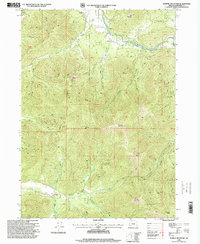
1996 Map of Murphy Mountain
USGS Topo · Published 1999About this map
Marble Mountain and Eagle Mountain anchor this rugged section of Josephine County, where the topography is defined by the steep drainages of the Applegate River and Deer Creek. The landscape reflects a legacy of extraction and land management, with a visible Mine, Quarry, and Gravel Pit scattered among the peaks. While much of the area is undeveloped forest land under the jurisdiction of the Forest Service, specific human infrastructure like the Gaging Sta along the river and the Lookout Round Top atop Roundtop Mountain highlight the technical oversight of the river system and fire prevention. Recreational and local landmarks such as Fish Hatchery Park and the Packers Creek Trail offer a look at how the community interacted with the Siskiyou foothills in the mid-1990s.
Find a feature on this map
35 named features on this map. Tap any name to fly to it.
Don’t see what you’re looking for? This feature index may not catch every label — zoom into the map to look around manually.
Map Details
Editions of this 1996 Murphy Mountain Map
This is the sole edition of this map. No revisions or reprints were ever made.
Other maps of this area

1908 · Grants Pass
USGS Topo · 1:125,000

1917 · Kerby
USGS Topo · 1:125,000

1918 · Kerby
USGS Topo · 1:125,000

1945 · Kerby
USGS Topo · 1:125,000

1954 · Cave Junction
USGS Topo · 1:62,500

1954 · Oregon Caves
USGS Topo · 1:62,500

1954 · Selma
USGS Topo · 1:62,500

1954 · Grants Pass
USGS Topo · 1:62,500

1955 · Medford
USGS Topo · 1:250,000

1957 · Medford
USGS Topo · 1:250,000