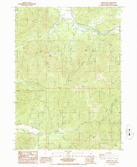
1986 Map of Murphy Mtn
USGS Topo · Published 1986About this map
The Applegate River corridor defines the northern reaches of this Josephine County landscape, where the Applegate Fish Hatchery Park sits nestled near the base of Bolt Mountain. Evidence of early industrial activity and transit is preserved through the Old Railroad Grade north of Cheney Creek, while several extraction sites like the Quarry near Marble Mountain and a Gravel Pit indicate the local reliance on geological resources. To the south, the topography is dominated by the steep rises of Murphy Mtn and Mungers Butte, separated by the drainage basins of Deer Creek and its many forks. This 1980s provisional study provides a clear view of the complex waterway network, including Jackson Creek and Harmon Creek, as it existed before contemporary development or changing forest management practices altered the watershed.
Find a feature on this map
31 named features on this map. Tap any name to fly to it.
Don’t see what you’re looking for? This feature index may not catch every label — zoom into the map to look around manually.
Map Details
Editions of this 1986 Murphy Mtn Map
This is the sole edition of this map. No revisions or reprints were ever made.
Other maps of this area

1908 · Grants Pass
USGS Topo · 1:125,000

1917 · Kerby
USGS Topo · 1:125,000

1918 · Kerby
USGS Topo · 1:125,000

1945 · Kerby
USGS Topo · 1:125,000

1954 · Cave Junction
USGS Topo · 1:62,500

1954 · Oregon Caves
USGS Topo · 1:62,500

1954 · Selma
USGS Topo · 1:62,500

1954 · Grants Pass
USGS Topo · 1:62,500

1955 · Medford
USGS Topo · 1:250,000

1957 · Medford
USGS Topo · 1:250,000