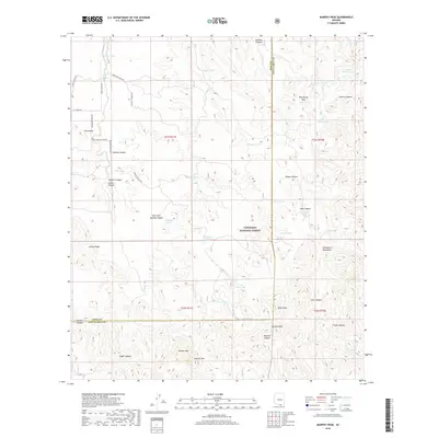
2018 Map of Murphy Peak
USGS Topo · Published 2018About this map
Murphy Peak and Bartolo Mtn anchor this high-desert landscape along the border of Pima and Santa Cruz counties. The terrain is characterized by a complex network of arroyos and canyons, including Murphy Canyon, Jalisco Canyon, and Cedar Canyon, which flow through the western foothills of the Tumacacori Mountains. Evidence of a water-dependent ranching economy is visible in the numerous livestock tanks scattered across the land, such as Bear Grass Tank, Moyza Tank, and Amole Tank.
Find a feature on this map
56 named features on this map. Tap any name to fly to it.
Don’t see what you’re looking for? This feature index may not catch every label — zoom into the map to look around manually.
Map Details
Editions of this 2018 Murphy Peak Map
This is the sole edition of this map. No revisions or reprints were ever made.
Other maps of this area

1920 · Arivaca
USGS Topo · 1:125,000

1921 · Old Glory
USGS Topo · 1:125,000

1939 · Tubac
USGS Topo · 1:62,500

1941 · Arivaca
USGS Topo · 1:62,500

1942 · Ruby
USGS Topo · 1:62,500

1942 · Oro Blanco
USGS Topo · 1:62,500

1943 · Arivaca
USGS Topo · 1:62,500

1943 · Old Glory
USGS Topo · 1:125,000

1943 · Tubac
USGS Topo · 1:62,500

1944 · Oro Blanco
USGS Topo · 1:62,500