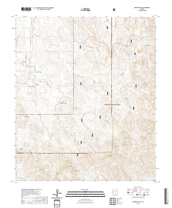
2021 Map of Murphy Peak
USGS Topo · Published 2021About this map
Murphy Peak and Dicks Peak dominate the skyline in this southern Arizona landscape, marking the transition between the Tumacacori Mountains and the arid desert floor. This region, much of which is managed within the Coronado National Forest, is defined by a network of water-harvesting features such as Papalote Tank, Moyza Tank, and Lobo Tank. These man-made and natural catchments were historically essential for ranching and survival in the high-desert canyons.
Find a feature on this map
60 named features on this map. Tap any name to fly to it.
Don’t see what you’re looking for? This feature index may not catch every label — zoom into the map to look around manually.
Map Details
Editions of this 2021 Murphy Peak Map
This is the sole edition of this map. No revisions or reprints were ever made.
Other maps of this area

1920 · Arivaca
USGS Topo · 1:125,000

1921 · Old Glory
USGS Topo · 1:125,000

1939 · Tubac
USGS Topo · 1:62,500

1941 · Arivaca
USGS Topo · 1:62,500

1942 · Ruby
USGS Topo · 1:62,500

1942 · Oro Blanco
USGS Topo · 1:62,500

1943 · Arivaca
USGS Topo · 1:62,500

1943 · Old Glory
USGS Topo · 1:125,000

1943 · Tubac
USGS Topo · 1:62,500

1944 · Oro Blanco
USGS Topo · 1:62,500