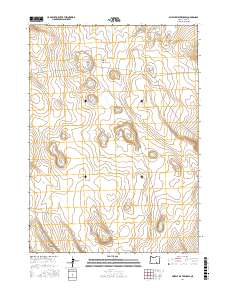
2017 Map of Murphy Waterholes
USGS Topo · Published 2017About this map
Murphy Waterholes and a network of essential desert catchments anchor this 2017 survey of Lake County. This arid landscape is defined by its water management, where named features such as Pistol Lake and Zero Waterhole indicate the critical points of hydration in an otherwise dry high-desert environment. The map details the vast drainage systems of the region, including Sixmile Draw and the deep relief of Black Canyon at the southwestern corner. Historically, these waterholes served as vital waypoints for ranchers and travelers moving through the high plateau. The survey meticulously records these land features alongside the Public Land Survey System grids of t34s r27e, t34s r28e, t35s r27e, and t35s r28e, providing a clear record of land ownership and natural topography in the early 21st century.
Find a feature on this map
12 named features on this map. Tap any name to fly to it.
Don’t see what you’re looking for? This feature index may not catch every label — zoom into the map to look around manually.
Map Details
Editions of this 2017 Murphy Waterholes Map
This is the sole edition of this map. No revisions or reprints were ever made.
Other maps of this area

1955 · Adel
USGS Topo · 1:250,000

1957 · Adel
USGS Topo · 1:250,000

1958 · Adel
USGS Topo · 1:250,000

1962 · Adel
USGS Topo · 1:250,000

1966 · Bluejoint Lake East
USGS Topo · 1:24,000

1967 · Flook Lake
USGS Topo · 1:24,000

1967 · Swede Knoll
USGS Topo · 1:24,000

1971 · Beatys Butte
USGS Topo · 1:24,000

1971 · Murphy Waterholes
USGS Topo · 1:24,000
1971 · Sixmile Draw
USGS Topo · 1:24,000