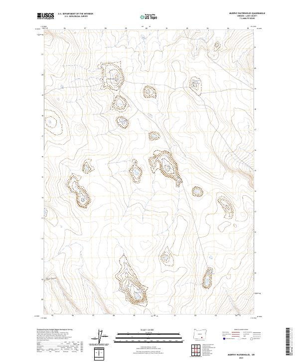
2023 Map of Murphy Waterholes
USGS Topo · Published 2023About this map
Hart Mountain National Antelope Refuge defines this portion of the high desert in Lake County, where water is the primary driver of the landscape's character and nomenclature. The map reveals a network of crucial watering points, including Murphy Waterhole, Socket Waterhole, and Zero Waterhole, which have likely served both wildlife and livestock for decades. These named basins, along with Pistol Lake and the Westside Waterhole, indicate the importance of seasonal hydrology in an otherwise arid environment. The terrain is marked by subtle shifts in elevation, leading toward Black Canyon in the southwest. This modern survey from the U.S. Geological Survey utilizes data from the National Hydrography Dataset to document these critical water resources within the refuge's protected boundaries.
Find a feature on this map
12 named features on this map. Tap any name to fly to it.
Don’t see what you’re looking for? This feature index may not catch every label — zoom into the map to look around manually.
Map Details
Editions of this 2023 Murphy Waterholes Map
This is the sole edition of this map. No revisions or reprints were ever made.
Other maps of this area

1955 · Adel
USGS Topo · 1:250,000

1957 · Adel
USGS Topo · 1:250,000

1958 · Adel
USGS Topo · 1:250,000

1962 · Adel
USGS Topo · 1:250,000

1966 · Bluejoint Lake East
USGS Topo · 1:24,000

1967 · Flook Lake
USGS Topo · 1:24,000

1967 · Swede Knoll
USGS Topo · 1:24,000

1971 · Beatys Butte
USGS Topo · 1:24,000

1971 · Murphy Waterholes
USGS Topo · 1:24,000
1971 · Sixmile Draw
USGS Topo · 1:24,000