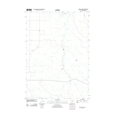
2012 Map of Murray Draw
USGS Topo · Published 2012About this map
West Fork anchors this section of Haakon County, where the high plains are carved by an intricate network of seasonal drainage patterns and creek beds. The landscape is defined by its namesake topographical depressions, including Murray Draw and Middle Draw, which dictate the sparse road network of this ranching country. Local transport relies on a grid of section-line roads such as 225th Ave and 203rd St, while Singleton Rd skirts the northern reaches. Hydrological features like W Plum Cr, Shanty Cr, and Long Br trace the natural path of water through the terrain, illustrating the geographic challenges of settlement in the western South Dakota prairie during the early 21st century.
Find a feature on this map
10 named features on this map. Tap any name to fly to it.
Don’t see what you’re looking for? This feature index may not catch every label — zoom into the map to look around manually.
Map Details
Editions of this 2012 Murray Draw Map
This is the sole edition of this map. No revisions or reprints were ever made.
Other maps of this area

1954 · Pierre
USGS Topo · 1:250,000

1955 · Rattlesnake Lake SE
USGS Topo · 1:24,000

1955 · Rattlesnake Lake SW
USGS Topo · 1:24,000

1956 · Cherry Creek
USGS Topo · 1:24,000

1958 · Pierre
USGS Topo · 1:250,000

1983 · Mule Creek
USGS Topo · 1:24,000

1983 · Philip
USGS Topo · 1:100,000

1983 · Milesville
USGS Topo · 1:24,000

1983 · Middle Draw
USGS Topo · 1:24,000

1983 · Tornado Ranch
USGS Topo · 1:24,000