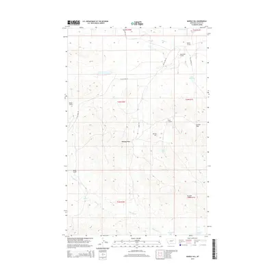
2014 Map of Murray Hill
USGS Topo · Published 2014About this map
Murray Place sits at the heart of this Valley County landscape, a region defined by the complex drainage systems and ridges typical of the Missouri River breaks. The topography is marked by significant features like Shufeldt Ridge and Van Hook Ridge, which overlook a network of coulees including Barber Coulee and King Coulee. Water sources are critical in this arid environment, represented by named locations such as King Spring and Sullivan Spring, alongside more substantial bodies like Valley Reservoir. To the south, the terrain descends toward the northern reaches of Fort Peck Lake, where Sutherland Cr and Plum Cr meet the water. The map traces the essential transit corridors of Willow Creek Rd and Murray Rd, illustrating how early 21st-century infrastructure navigated the prominent elevation of Murray Hill.
Find a feature on this map
24 named features on this map. Tap any name to fly to it.
Don’t see what you’re looking for? This feature index may not catch every label — zoom into the map to look around manually.
Map Details
Editions of this 2014 Murray Hill Map
This is the sole edition of this map. No revisions or reprints were ever made.
Other maps of this area

1954 · Jordan
USGS Topo · 1:250,000

1956 · Jordan
USGS Topo · 1:250,000

1958 · Jordan
USGS Topo · 1:250,000

1958 · Collins Ranch
USGS Topo · 1:62,500

1958 · Maloney Hill
USGS Topo · 1:62,500

1964 · Jordan
USGS Topo · 1:250,000

1971 · Wagon Coulee
USGS Topo · 1:24,000

1971 · Harper Camp
USGS Topo · 1:24,000
1973 · Triple Crossing Reservoir East
USGS Topo · 1:24,000

1973 · Triple Crossing Reservoir West
USGS Topo · 1:24,000