
1958 Map of Collins Ranch
USGS Topo · Published 1960About this map
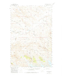
The Collins Ranch and other scattered homesteads including Browning Ranch and Wittmayer Ranch anchor this landscape of the Missouri River Basin just as the postwar era brought systematic water management to the high plains. The terrain is defined by an intricate network of drainage coulees, such as Pearson Coulee and Browning Coulee, and the significant elevation changes at Shufeldt Ridge and Seventh Ridge. A complex system of small-scale irrigation and stock water is evident through the numerous reservoirs like Divide Reservoir, Bomber Reservoir, and Cottonwood Reservoir. To the south, the map details the northern reaches of the Fort Peck Game Range near the Fort Peck Reservoir, showing the transition from grazing rangelands to protected conservation areas. Genealogists may find interest in the specific ranch locations and landmarks like Graveyard Hill, while the presence of the Virgelle Road and various gravel pits indicates the infrastructure supporting this isolated ranching community.
Find a feature on this map
72 named features on this map. Tap any name to fly to it.
Don’t see what you’re looking for? This feature index may not catch every label — zoom into the map to look around manually.
Map Details
Editions of this 1958 Collins Ranch Map
2 editions found
Other maps of this area

1943 · Glasgow
USGS Topo · 1:125,000

1954 · Jordan
USGS Topo · 1:250,000

1954 · Glasgow
USGS Topo · 1:250,000

1956 · Jordan
USGS Topo · 1:250,000

1957 · Glasgow
USGS Topo · 1:250,000

1958 · Glasgow
USGS Topo · 1:250,000

1958 · Jordan
USGS Topo · 1:250,000

1958 · Miller Coulee
USGS Topo · 1:62,500

1958 · Maloney Hill
USGS Topo · 1:62,500

1958 · Lewis Reservoir
USGS Topo · 1:24,000