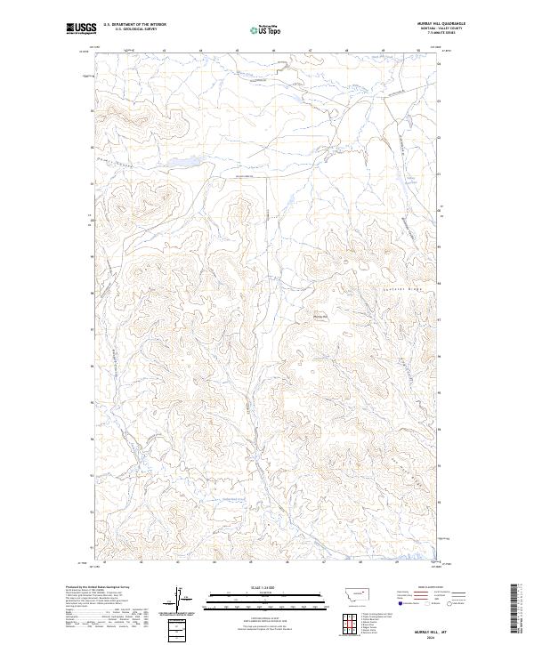
2024 Map of Murray Hill
USGS Topo · Published 2024About this map
Murray Hill and the surrounding high ridges of Valley County define this landscape, where the northern reaches of the Charles M Russell National Wildlife Refuge meet the expansive cattle country of northern Montana. The terrain is characterized by a series of deep coulees, such as Desert Coulee and Barber Coulee, that drain toward Willow Creek and Plum Creek. This 2024 survey illustrates the distribution of vital water sources in an arid environment, from the Valley Reservoir to isolated points like King Spring and Sullivan Spring. A network of gravel routes, including Stone House Rd and Murray Rd, provide access through the complex topography of Shufeldt Ridge and Van Hook Ridge, reflecting a modern landscape still governed by the township and range lines of the original Public Land Survey System.
Find a feature on this map
26 named features on this map. Tap any name to fly to it.
Don’t see what you’re looking for? This feature index may not catch every label — zoom into the map to look around manually.
Map Details
Editions of this 2024 Murray Hill Map
This is the sole edition of this map. No revisions or reprints were ever made.
Other maps of this area

1954 · Jordan
USGS Topo · 1:250,000

1956 · Jordan
USGS Topo · 1:250,000

1958 · Jordan
USGS Topo · 1:250,000

1958 · Collins Ranch
USGS Topo · 1:62,500

1958 · Maloney Hill
USGS Topo · 1:62,500

1964 · Jordan
USGS Topo · 1:250,000

1971 · Wagon Coulee
USGS Topo · 1:24,000

1971 · Harper Camp
USGS Topo · 1:24,000
1973 · Triple Crossing Reservoir East
USGS Topo · 1:24,000

1973 · Triple Crossing Reservoir West
USGS Topo · 1:24,000