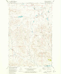
1973 Map of Murray Hill
USGS Topo · Published 1977About this map
Fort Peck Lake and the rugged coulees of the Charles M Russell National Wildlife Range dominate this northern Montana landscape during the early 1970s. The terrain is a network of drainage features like Barber Coulee and Vanwinkle Coulee that feed into the Missouri River basin's massive reservoir system. Scattered ranching improvements and seasonal water management sites are documented across the breaks, including Desert Dam and Halfpint Reservoir. Local family history and land use are etched into the map through named locations such as Handley Ranch, Murray Place, and the small settlement at Hard Pan. High points like Murray Hill and the prominent Shufeldt Ridge provide topographic context for this remote stretch of Valley County.
Find a feature on this map
24 named features on this map. Tap any name to fly to it.
Don’t see what you’re looking for? This feature index may not catch every label — zoom into the map to look around manually.
Map Details
Editions of this 1973 Murray Hill Map
This is the sole edition of this map. No revisions or reprints were ever made.
Other maps of this area

1954 · Jordan
USGS Topo · 1:250,000

1956 · Jordan
USGS Topo · 1:250,000

1958 · Jordan
USGS Topo · 1:250,000

1958 · Collins Ranch
USGS Topo · 1:62,500

1958 · Maloney Hill
USGS Topo · 1:62,500

1964 · Jordan
USGS Topo · 1:250,000

1971 · Wagon Coulee
USGS Topo · 1:24,000

1971 · Harper Camp
USGS Topo · 1:24,000
1973 · Triple Crossing Reservoir East
USGS Topo · 1:24,000

1973 · Triple Crossing Reservoir West
USGS Topo · 1:24,000