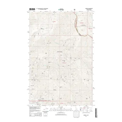
2013 Map of Murray
USGS Topo · Published 2013About this map
Murray occupies a narrow canyon floor where Prichard Cr meets Gold Run, serving as a central point for the drainage systems of the Bitterroot Range. This high-country landscape is defined by its deep gulches and prominent peaks, including Murray Peak and Little Baldy. The map documents the complex boundary between the Coeur D'Alene National Forest and Kaniksu National Forest, as well as the high-altitude state line between Idaho and Montana. Water is a primary feature of the terrain, with names like Bloom Spring, Berry Lake, and E Lake marking the upper reaches of the drainage basins. The network of forest roads, such as Bobtail Rd and W Eagle Rd, provides access to numerous named geological features like Pennsylvania Gulch and Jack Waite Forks, reflecting the area's long history of mineral exploration and timber management.
Find a feature on this map
60 named features on this map. Tap any name to fly to it.
Don’t see what you’re looking for? This feature index may not catch every label — zoom into the map to look around manually.
Map Details
Editions of this 2013 Murray Map
This is the sole edition of this map. No revisions or reprints were ever made.
Other maps of this area

1901 · Coeur D'Alene District
USGS Topo · 1:62,500

1903 · Coeur D'Alene District
USGS Topo · 1:62,500

1906 · Coeur D'Alene District
USGS Topo · 1:62,500

1932 · Trout Creek
USGS Topo · 1:125,000

1935 · Trout Creek
USGS Topo · 1:125,000

1936 · Trout Creek
USGS Topo · 1:125,000

1956 · Cooper Gulch
USGS Topo · 1:62,500

1956 · Wallace
USGS Topo · 1:250,000

1957 · Burke
USGS Topo · 1:62,500

1960 · Wallace
USGS Topo · 1:250,000