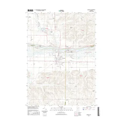
2016 Map of Muscoda
USGS Topo · Published 2016About this map
The Wisconsin River serves as the central artery for this region, winding past the village of Muscoda and the settlement of Orion. The river’s complex floodplains are marked by a series of distinct water features and islands, including McClary Island, Whites Slough, and Big Cat Slough. This network of sloughs and backwaters, such as Goodwiler Lake and Long Lake, illustrates the dynamic nature of the river valley before it meets the surrounding ridges.
Find a feature on this map
98 named features on this map. Tap any name to fly to it.
Don’t see what you’re looking for? This feature index may not catch every label — zoom into the map to look around manually.
Map Details
Editions of this 2016 Muscoda Map
This is the sole edition of this map. No revisions or reprints were ever made.
Other maps of this area

1905 · Richland Center
USGS Topo · 1:125,000

1933 · Boaz
USGS Topo · 1:62,500

1933 · Boscobel
USGS Topo · 1:62,500

1958 · La Crosse
USGS Topo · 1:250,000

1960 · Richland Center
USGS Topo · 1:62,500

1960 · Muscoda
USGS Topo · 1:62,500

1961 · La Crosse
USGS Topo · 1:250,000

1965 · La Crosse
USGS Topo · 1:250,000

1966 · Boaz
USGS Topo · 1:62,500
1967 · Boscobel
USGS Topo · 1:62,500