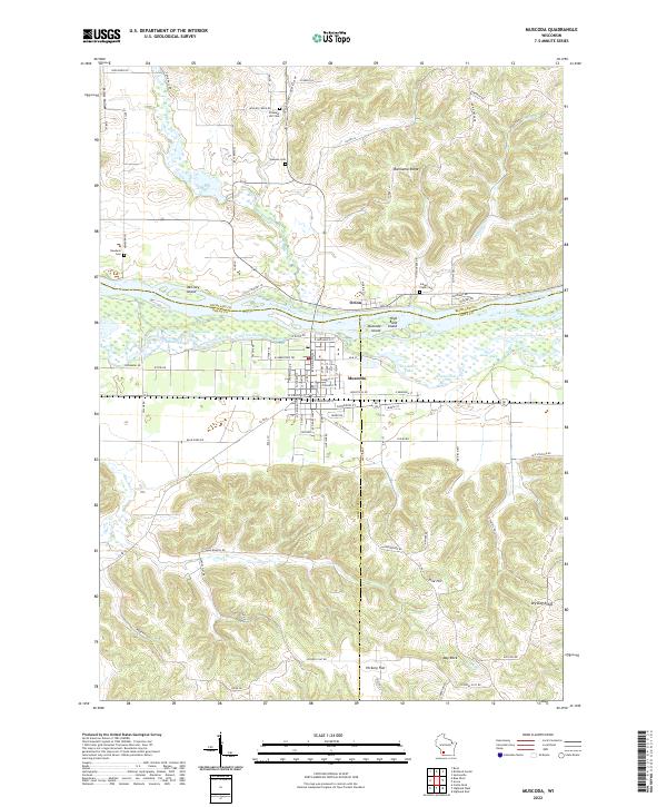
2022 Map of Muscoda
USGS Topo · Published 2022About this map
The Wisconsin River corridor near Muscoda serves as a meeting point for three counties, where the river's path creates a complex network of wetlands and backwaters. Between the northern banks at Orion and the village of Muscoda, the river landscape is defined by features like Muscoda Island, McClary Island, and the curving waters of Whites Slough and Big Cat Slough. This environment suggests a long history of river navigation and adaptation to the fluctuating water levels of the floodplain.
Find a feature on this map
106 named features on this map. Tap any name to fly to it.
Don’t see what you’re looking for? This feature index may not catch every label — zoom into the map to look around manually.
Map Details
Editions of this 2022 Muscoda Map
This is the sole edition of this map. No revisions or reprints were ever made.
Other maps of this area

1905 · Richland Center
USGS Topo · 1:125,000

1933 · Boaz
USGS Topo · 1:62,500

1933 · Boscobel
USGS Topo · 1:62,500

1958 · La Crosse
USGS Topo · 1:250,000

1960 · Richland Center
USGS Topo · 1:62,500

1960 · Muscoda
USGS Topo · 1:62,500

1961 · La Crosse
USGS Topo · 1:250,000

1965 · La Crosse
USGS Topo · 1:250,000

1966 · Boaz
USGS Topo · 1:62,500
1967 · Boscobel
USGS Topo · 1:62,500