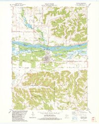
1983 Map of Muscoda
USGS Topo · Published 1983About this map
The Wisconsin River defines the landscape of this 1983 survey, dividing the village of Muscoda from the scattered northern settlements of Orion and Eagle Corners. The river valley is a complex network of wetlands and backwaters, including Big Cat Slough, Whites Slough, and Dixon Lake, much of which is preserved within the Lower Wisconsin State Wildlife Area. This era shows the region's rural infrastructure firmly established, with the Fourth Principal Meridian bisecting the quadrangle as a foundational surveying line.
Find a feature on this map
47 named features on this map. Tap any name to fly to it.
Don’t see what you’re looking for? This feature index may not catch every label — zoom into the map to look around manually.
Map Details
Editions of this 1983 Muscoda Map
This is the sole edition of this map. No revisions or reprints were ever made.
Other maps of this area

1905 · Richland Center
USGS Topo · 1:125,000

1933 · Boaz
USGS Topo · 1:62,500

1933 · Boscobel
USGS Topo · 1:62,500

1958 · La Crosse
USGS Topo · 1:250,000

1960 · Richland Center
USGS Topo · 1:62,500

1960 · Muscoda
USGS Topo · 1:62,500

1961 · La Crosse
USGS Topo · 1:250,000

1965 · La Crosse
USGS Topo · 1:250,000

1966 · Boaz
USGS Topo · 1:62,500
1967 · Boscobel
USGS Topo · 1:62,500