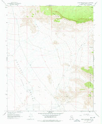
1968 Map of Music Mountains NW
USGS Topo · Published 1978About this map
The Grand Wash Cliffs dominate the northern landscape of this Mohave County region, creating a dramatic geological transition between the high plateaus and the lower desert basins. To the southwest, the Hualapai Valley (Depression) opens up, providing a stark contrast to the elevated terrain of the Music Mountains and the boundary of the Hualapai Indian Res in the northeast corner.
Find a feature on this map
16 named features on this map. Tap any name to fly to it.
Don’t see what you’re looking for? This feature index may not catch every label — zoom into the map to look around manually.
Map Details
Editions of this 1968 Music Mountains NW Map
2 editions found
Other maps of this area

1886 · Diamond Creek
USGS Topo · 1:250,000

1886 · Camp Mohave
USGS Topo · 1:250,000

1892 · Diamond Creek
USGS Topo · 1:250,000

1892 · Camp Mohave
USGS Topo · 1:250,000

1942 · Camp Mohave
USGS Topo · 1:250,000

1947 · Kingman
USGS Topo · 1:250,000

1948 · Kingman
USGS Topo · 1:250,000

1948 · Williams
USGS Topo · 1:250,000

1954 · Kingman
USGS Topo · 1:250,000

1954 · Williams
USGS Topo · 1:250,000