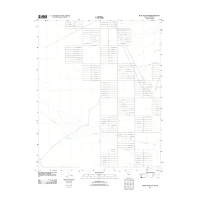
2011 Map of Music Mountains SW
USGS Topo · Published 2011About this map
Truxton Wash carves through this arid corner of Mohave County, defining the drainage patterns across a planned but largely undeveloped residential grid. The landscape is characterized by a dense network of surveyed streets with ambitious names like Buena Vista Blvd and El Mirage Blvd, which stand in stark contrast to the natural desert terrain. This pattern suggests an era of speculative land platting, where wide thoroughfares such as Santa Barbara Blvd were mapped over the existing environment. Human activity is largely represented by isolated water features crucial for ranching or local survival, including Marshall Tank, Crack Tank, and Hackberry Tank. These small catchments are the primary landmarks in an otherwise open expanse of desert floor and dry washes, reflecting the challenges of water management in northern Arizona.
Find a feature on this map
78 named features on this map. Tap any name to fly to it.
Don’t see what you’re looking for? This feature index may not catch every label — zoom into the map to look around manually.
Map Details
Editions of this 2011 Music Mountains SW Map
This is the sole edition of this map. No revisions or reprints were ever made.
Other maps of this area

1886 · Diamond Creek
USGS Topo · 1:250,000

1886 · Camp Mohave
USGS Topo · 1:250,000

1892 · Diamond Creek
USGS Topo · 1:250,000

1892 · Camp Mohave
USGS Topo · 1:250,000

1939 · Chloride
USGS Topo · 1:48,000

1942 · Camp Mohave
USGS Topo · 1:250,000

1944 · Chloride
USGS Topo · 1:62,500

1947 · Kingman
USGS Topo · 1:250,000

1948 · Kingman
USGS Topo · 1:250,000

1948 · Williams
USGS Topo · 1:250,000