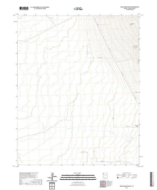
2021 Map of Music Mountains SW
USGS Topo · Published 2021About this map
Grand Wash Cliffs dominate the northern landscape of this Mojave County region, where the terrain drops sharply toward the Hualapai Valley. This 2021 survey illustrates a sparse desert environment defined by essential water catchment points like Marshall Tank and Crack Tank, which are critical landmarks in a territory where permanent water is rare. The drainage of Truxton Wash cuts horizontally across the southern half of the map, serving as a primary geographical feature for this high-desert basin. While much of the land remains undeveloped, the emergence of a rectilinear road grid—including Kaibito Blvd, Pima Rd, and Saguaro Blvd—signals a modern layer of planned settlement atop the older desert washes. This map provides a clear view of how transit corridors like Co Hwy 149 navigate the steep elevation changes of the cliffs to connect the plateau with the valley floor.
Find a feature on this map
20 named features on this map. Tap any name to fly to it.
Don’t see what you’re looking for? This feature index may not catch every label — zoom into the map to look around manually.
Map Details
Editions of this 2021 Music Mountains SW Map
This is the sole edition of this map. No revisions or reprints were ever made.
Other maps of this area

1886 · Diamond Creek
USGS Topo · 1:250,000

1886 · Camp Mohave
USGS Topo · 1:250,000

1892 · Diamond Creek
USGS Topo · 1:250,000

1892 · Camp Mohave
USGS Topo · 1:250,000

1939 · Chloride
USGS Topo · 1:48,000

1942 · Camp Mohave
USGS Topo · 1:250,000

1944 · Chloride
USGS Topo · 1:62,500

1947 · Kingman
USGS Topo · 1:250,000

1948 · Kingman
USGS Topo · 1:250,000

1948 · Williams
USGS Topo · 1:250,000