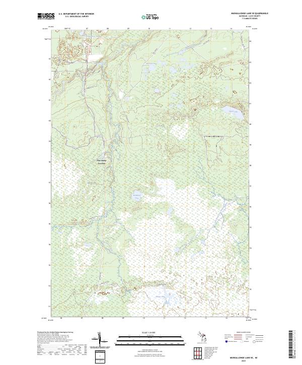
2023 Map of Muskallonge Lake SE
USGS Topo · Published 2023About this map
Pine Stump Junction serves as a central landmark in this remote corner of Luce County, where a network of trails and county roads converges amidst a complex landscape of wetlands and water. The famous Two Hearted River winds through the northern sections, joined by the East Branch Two Hearted River and fed by numerous tributaries such as Wabash Creek and Whiskey Creek. This 2023 survey illustrates a wilderness characterized by extensive swampy basins and isolated lakes, including McMahon Lake, Sleeper Lake, and the curiously named Old Headquarters Lake. The absence of dense settlement highlights the area's preservation as a primitive natural corridor, defined by timber management and recreation trails like the Pine Ridge Trl and Dawson Trl.
Find a feature on this map
35 named features on this map. Tap any name to fly to it.
Don’t see what you’re looking for? This feature index may not catch every label — zoom into the map to look around manually.
Map Details
Editions of this 2023 Muskallonge Lake SE Map
This is the sole edition of this map. No revisions or reprints were ever made.
Other maps of this area

1954 · Sault Sainte Marie
USGS Topo · 1:250,000

1956 · Sault Sainte Marie
USGS Topo · 1:250,000

1957 · Sault Sainte Marie
USGS Topo · 1:250,000

1958 · Sault Sainte Marie
USGS Topo · 1:250,000

1962 · Auger Lake
USGS Topo · 1:24,000

1968 · Muskallonge Lake East
USGS Topo · 1:24,000

1968 · Muskallonge Lake SW
USGS Topo · 1:24,000

1968 · Muskallonge Lake West
USGS Topo · 1:24,000

1968 · Muskallonge Lake SE
USGS Topo · 1:24,000

1968 · Betsy Lake NW
USGS Topo · 1:24,000