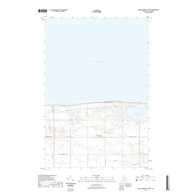
2019 Map of Muskallonge Lake West
USGS Topo · Published 2019About this map
Lake Superior dominates the northern horizon of this coastal Luce County landscape, where the shoreline is traced by the N Country National Scenic Trail. The interior is defined by a dense network of inland water bodies, most notably Muskallonge Lake and the winding course of the Blind Sucker River. This area represents a classic Upper Peninsula forest and wetland environment, largely managed through a system of resource-access routes like the Grand Marais Truck Trl and Sevenmile Fire Lane Rd.
Find a feature on this map
23 named features on this map. Tap any name to fly to it.
Don’t see what you’re looking for? This feature index may not catch every label — zoom into the map to look around manually.
Map Details
Editions of this 2019 Muskallonge Lake West Map
This is the sole edition of this map. No revisions or reprints were ever made.
Other maps of this area

1954 · Sault Sainte Marie
USGS Topo · 1:250,000

1956 · Sault Sainte Marie
USGS Topo · 1:250,000

1957 · Sault Sainte Marie
USGS Topo · 1:250,000

1958 · Sault Sainte Marie
USGS Topo · 1:250,000

1968 · Muskallonge Lake East
USGS Topo · 1:24,000

1968 · Muskallonge Lake SW
USGS Topo · 1:24,000

1968 · Muskallonge Lake West
USGS Topo · 1:24,000

1968 · Muskallonge Lake SE
USGS Topo · 1:24,000
1968 · Grand Marais SE
USGS Topo · 1:24,000
1968 · Grand Marais NE
USGS Topo · 1:24,000