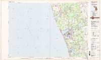
1982 Map of Muskegon
USGS Topo · Published 1982About this map
Muskegon and its industrial shoreline dominate this early 1980s topographic study of the eastern Lake Michigan coast. The map illustrates a dense corridor of development stretching from North Muskegon south through Muskegon Heights and Norton Shores, revealing how the region’s geography is defined by deep-water harbors like Muskegon Lake and White Lake. The era’s transportation network is prominently displayed, featuring the Grand Trunk Western and Chesapeake and Ohio railroads connecting the coastal port towns of Grand Haven and Ferrysburg to the interior.
Find a feature on this map
63 named features on this map. Tap any name to fly to it.
Don’t see what you’re looking for? This feature index may not catch every label — zoom into the map to look around manually.
Map Details
Editions of this 1982 Muskegon Map
This is the sole edition of this map. No revisions or reprints were ever made.
Other maps of this area

1929 · Montague
USGS Topo · 1:48,000

1929 · Holland
USGS Topo · 1:62,500

1930 · Lake Harbor
USGS Topo · 1:48,000

1930 · Muskegon
USGS Topo · 1:62,500

1931 · Hart SE
USGS Topo · 1:31,680

1931 · Walkerville SW
USGS Topo · 1:31,680

1931 · Walkerville SE
USGS Topo · 1:31,680

1932 · Holland
USGS Topo · 1:62,500

1936 · Muskegon
USGS Topo · 1:62,500

1936 · Lake Harbor
USGS Topo · 1:62,500