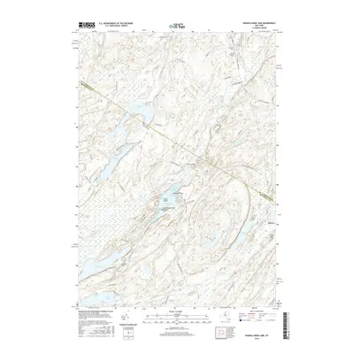
2016 Map of Muskellunge Lake
USGS Topo · Published 2016About this map
The Indian River winds through a dense landscape of glacially-carved lakes and wetlands along the border of Jefferson and St. Lawrence Counties. This region is defined by its complex shoreline geometry, seen in the numerous bays of Muskellunge Lake, such as Oscars Bay and Zekes Bay, and the distinctive landforms of Elephants Foot and Big Island. To the east, the settlement of Oxbow sits near a dramatic bend in the river, while the local geography is dotted with family-named landmarks and historical sites like Saint Patricks Cem and Riverside Cem.
Find a feature on this map
68 named features on this map. Tap any name to fly to it.
Don’t see what you’re looking for? This feature index may not catch every label — zoom into the map to look around manually.
Map Details
Editions of this 2016 Muskellunge Lake Map
This is the sole edition of this map. No revisions or reprints were ever made.
Other maps of this area

1903 · Alexandria Bay
USGS Topo · 1:62,500

1903 · Theresa
USGS Topo · 1:62,500

1911 · Antwerp
USGS Topo · 1:62,500

1912 · Hammond
USGS Topo · 1:62,500

1943 · Redwood
USGS Topo · 1:31,680

1944 · Hammond
USGS Topo · 1:62,500

1948 · Theresa
USGS Topo · 1:24,000

1948 · Chippewa Bay
USGS Topo · 1:24,000
1948 · Theresa
USGS Topo · 1:62,500

1948 · Alexandria Bay
USGS Topo · 1:62,500