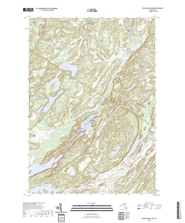
2023 Map of Muskellunge Lake
USGS Topo · Published 2023About this map
The Indian River cuts a prominent diagonal through this North Country landscape, where the border between St Lawrence and Jefferson Counties is defined by a straight survey line crossing the water. The settlement of Oxbow sits near a sharp bend in the river, while further north, the hamlet of Riverside is marked by the presence of Saint Patricks Cem. This region is characterized by a dense network of glacial lakes and wetlands, including the namesake Muskellunge Lake, Lake of the Woods, and Red Lake.
Find a feature on this map
68 named features on this map. Tap any name to fly to it.
Don’t see what you’re looking for? This feature index may not catch every label — zoom into the map to look around manually.
Map Details
Editions of this 2023 Muskellunge Lake Map
This is the sole edition of this map. No revisions or reprints were ever made.
Other maps of this area

1903 · Alexandria Bay
USGS Topo · 1:62,500

1903 · Theresa
USGS Topo · 1:62,500

1911 · Antwerp
USGS Topo · 1:62,500

1912 · Hammond
USGS Topo · 1:62,500

1943 · Redwood
USGS Topo · 1:31,680

1944 · Hammond
USGS Topo · 1:62,500

1948 · Theresa
USGS Topo · 1:24,000

1948 · Chippewa Bay
USGS Topo · 1:24,000
1948 · Theresa
USGS Topo · 1:62,500

1948 · Alexandria Bay
USGS Topo · 1:62,500