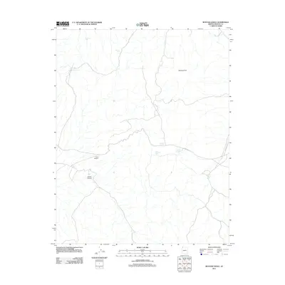
2011 Map of Mustang Knoll
USGS Topo · Published 2011About this map
Mustang Knoll stands as a central topographic feature in this arid section of Mohave County, where the landscape is defined by its scarce but vital water sources and deep drainage patterns. The drainage network includes Road Canyon and Hobble Canyon, which cut through the high desert floor. Human activity in this remote region is centered on ranching and aviation infrastructure, as evidenced by the Stock Driveway Reservoir and the Imlay Airstrip near the eastern boundary. Several water features, such as Mustang Spring, Alkaline Seep, and the Imlay Resort Tank, highlight the critical locations for livestock and local travel. Navigational routes like Co Hwy 101 provide the primary access through this sparsely populated territory, linking isolated tanks like Dutchman Tank and West Dutchman Tank to the broader regional network.
Find a feature on this map
13 named features on this map. Tap any name to fly to it.
Don’t see what you’re looking for? This feature index may not catch every label — zoom into the map to look around manually.
Map Details
Editions of this 2011 Mustang Knoll Map
This is the sole edition of this map. No revisions or reprints were ever made.
Other maps of this area

1886 · Mt. Trumbull
USGS Topo · 1:250,000

1892 · Mt. Trumbull
USGS Topo · 1:250,000

1953 · Grand Canyon
USGS Topo · 1:250,000

1954 · Littlefield 3 NE
USGS Topo · 1:24,000
1954 · Littlefield 3 SE
USGS Topo · 1:24,000

1954 · Littlefield
USGS Topo · 1:62,500

1954 · Cane Springs
USGS Topo · 1:62,500

1957 · Grand Canyon
USGS Topo · 1:250,000

1958 · Grand Canyon
USGS Topo · 1:250,000

1960 · Grand Canyon
USGS Topo · 1:250,000