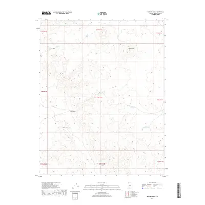
2018 Map of Mustang Knoll
USGS Topo · Published 2018About this map
Mustang Knoll stands as a prominent landmark in this high-desert portion of Mohave County, where the landscape is defined by its vital water sources and remote cattle ranching infrastructure. The availability of water dictated movement through this arid terrain, as evidenced by the distribution of Mustang Spring, Ide Valley Spring, and the Hidden Valley Spring in the northern reaches of the quadrangle. A system of stock management is visible through the placement of the Stock Driveway Reservoir and the Imlay Resort Tank, supporting the movement of livestock across the open range. Transportation in this era relied on established routes like Co HWY 101, which traverses the central and southern sections, navigating around significant geographical features such as Road Canyon and Hobble Canyon. This survey captures the essential intersection of hydrology and land use in a region where an Alkaline Seep can be as significant a landmark as a mountain peak.
Find a feature on this map
20 named features on this map. Tap any name to fly to it.
Don’t see what you’re looking for? This feature index may not catch every label — zoom into the map to look around manually.
Map Details
Editions of this 2018 Mustang Knoll Map
This is the sole edition of this map. No revisions or reprints were ever made.
Other maps of this area

1886 · Mt. Trumbull
USGS Topo · 1:250,000

1892 · Mt. Trumbull
USGS Topo · 1:250,000

1953 · Grand Canyon
USGS Topo · 1:250,000

1954 · Littlefield 3 NE
USGS Topo · 1:24,000
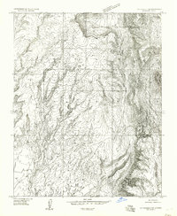
1954 · Littlefield 3 SE
USGS Topo · 1:24,000

1954 · Littlefield
USGS Topo · 1:62,500

1954 · Cane Springs
USGS Topo · 1:62,500

1957 · Grand Canyon
USGS Topo · 1:250,000

1958 · Grand Canyon
USGS Topo · 1:250,000

1960 · Grand Canyon
USGS Topo · 1:250,000