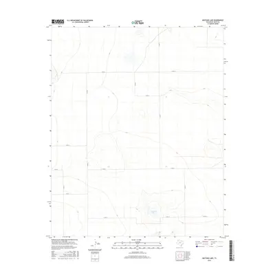
2016 Map of Mustang Lake
USGS Topo · Published 2016About this map
Mustang Lake sits as the central geographic landmark in this high-plains landscape of western Deaf Smith County. The terrain is defined by a rigorous grid of rural transport routes, including Co Rd UU, Co Rd 16, and Co Rd T, which segment the territory into massive agricultural plots. This 2016 survey illustrates the modern layout of the Llano Estacado, where the natural depressions of ephemeral basins like Mustang Lake interrupt the engineered precision of the road network. The map reveals the persistent influence of the Public Land Survey System on the Texas Panhandle, with roads such as Co Rd 10 and Co Rd SS tracing the section lines that have governed local land use for over a century.
Find a feature on this map
12 named features on this map. Tap any name to fly to it.
Don’t see what you’re looking for? This feature index may not catch every label — zoom into the map to look around manually.
Map Details
Editions of this 2016 Mustang Lake Map
This is the sole edition of this map. No revisions or reprints were ever made.
Other maps of this area

1954 · Tucumcari
USGS Topo · 1:250,000

1954 · Clovis
USGS Topo · 1:250,000

1958 · Clovis
USGS Topo · 1:250,000

1958 · Tucumcari
USGS Topo · 1:250,000

1966 · Sand Point
USGS Topo · 1:24,000

1966 · Norton Lake
USGS Topo · 1:24,000

1968 · Rock Camp
USGS Topo · 1:24,000

1971 · Mustang Lake
USGS Topo · 1:24,000

1971 · Bootleg
USGS Topo · 1:24,000

1971 · Garcia Lake
USGS Topo · 1:24,000