
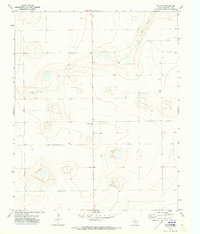
1971 Map of Mustang Lake
USGS Topo · Published 1973About this map
Mustang Lake sits as a prominent hydrological feature in this high plains landscape on the western edge of Deaf Smith County. The terrain is defined by dramatic contour changes leading down to the lake bed, contrasting with the relatively flat plateau that stretches toward the New Mexico State Line. This 1971 survey captures a sparsely populated section of the Texas Panhandle, where the land is primarily organized by a network of ranch roads and section lines. The map reveals the intricate topographic depressions and basins characteristic of the region, providing a detailed record of the natural drainage and elevation patterns before modern land use might have altered these local catchments.
Find a feature on this map
2 named features on this map. Tap any name to fly to it.
Don’t see what you’re looking for? This feature index may not catch every label — zoom into the map to look around manually.
Map Details
Editions of this 1971 Mustang Lake Map
This is the sole edition of this map. No revisions or reprints were ever made.
Other maps of this area

1954 · Tucumcari
USGS Topo · 1:250,000

1954 · Clovis
USGS Topo · 1:250,000

1958 · Clovis
USGS Topo · 1:250,000

1958 · Tucumcari
USGS Topo · 1:250,000

1966 · Sand Point
USGS Topo · 1:24,000

1966 · Norton Lake
USGS Topo · 1:24,000

1968 · Rock Camp
USGS Topo · 1:24,000

1971 · Bootleg
USGS Topo · 1:24,000

1971 · Garcia Lake
USGS Topo · 1:24,000
1971 · Walcott
USGS Topo · 1:24,000