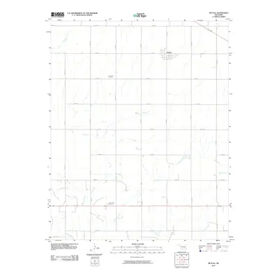
2010 Map of Mutual
USGS Topo · Published 2010About this map
Mutual serves as the primary settlement on this Woodward County landscape, situated amidst a highly structured grid of section line roads. The area's genealogical history is anchored by Persimmon Cemetery in the north and Sunny Side Cemetery to the south, marking the long-standing community centers of the prairie. The terrain is defined by a network of drainage systems, including Bent Creek, Cottonwood Creek, and Hackberry Creek, which cut through the agricultural blocks. A strictly organized road system, featuring routes like N 2120 RD and E 0540 RD, illustrates the late 20th-century development of Oklahoma's rural infrastructure. This 2010 survey reflects a landscape where traditional land divisions remain firmly in place even as modern transportation networks connect the remote corners of the county.
Find a feature on this map
23 named features on this map. Tap any name to fly to it.
Don’t see what you’re looking for? This feature index may not catch every label — zoom into the map to look around manually.
Map Details
Editions of this 2010 Mutual Map
This is the sole edition of this map. No revisions or reprints were ever made.
Other maps of this area

1955 · Woodward
USGS Topo · 1:250,000

1958 · Woodward
USGS Topo · 1:250,000

1969 · Mooreland SE
USGS Topo · 1:24,000

1969 · Sharon
USGS Topo · 1:24,000

1969 · Mooreland SW
USGS Topo · 1:24,000

1969 · Mutual SW
USGS Topo · 1:24,000

1969 · Mutual
USGS Topo · 1:24,000

1969 · Lenora
USGS Topo · 1:24,000

1969 · Camargo
USGS Topo · 1:24,000

1969 · Vici
USGS Topo · 1:24,000