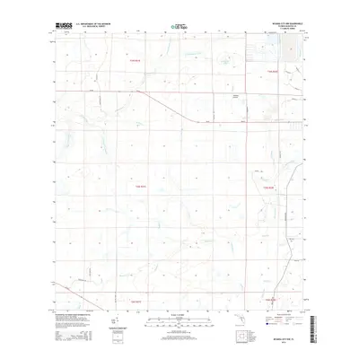
2015 Map of Myakka City NW
USGS Topo · Published 2015About this map
The N Fork Manatee River and E Fork Manatee River converge in this corner of Manatee County, forming the headwaters of the main Manatee River. The landscape is defined by an intricate network of drainage and wetlands, including Johnson Prairie and the meandering Sand Slough. To the southeast, the Myakka River cuts across the terrain, joined by local tributaries like Taylor Cr and Long Cr. This 2015 survey shows a region largely preserved in its natural hydrologic state, with expansive parcels still organized by the Public Land Survey System. Human activity is evidenced by a grid of rural roads such as Wauchula Rd and SR-64 E, which connect isolated ranch lands and agricultural interests between the river basins. Significant water bodies like Clearwater Lake and Mud Lake anchor the low-lying geography of the interior.
Find a feature on this map
45 named features on this map. Tap any name to fly to it.
Don’t see what you’re looking for? This feature index may not catch every label — zoom into the map to look around manually.
Map Details
Editions of this 2015 Myakka City NW Map
This is the sole edition of this map. No revisions or reprints were ever made.
Other maps of this area

1944 · Rye
USGS Topo · 1:31,680

1944 · Verna
USGS Topo · 1:31,680

1944 · Miakka
USGS Topo · 1:31,680

1956 · Myakka City
USGS Topo · 1:24,000

1956 · Edgeville
USGS Topo · 1:24,000

1956 · Myakka City NW
USGS Topo · 1:24,000

1956 · Myakka Head
USGS Topo · 1:24,000

1956 · Duette
USGS Topo · 1:24,000

1956 · Keentown
USGS Topo · 1:24,000

1956 · Tampa
USGS Topo · 1:250,000