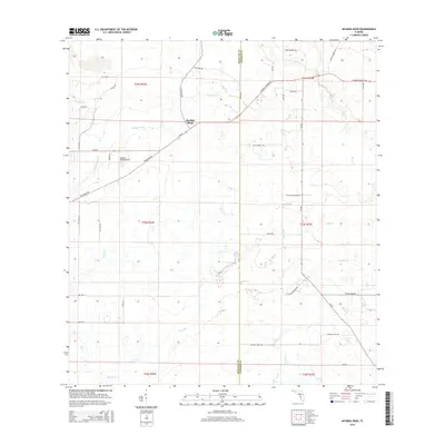
2015 Map of Myakka Head
USGS Topo · Published 2015About this map
The Myakka River headwaters define this landscape at the intersection of Manatee and Hardee Counties, where the water flows through a network of smaller tributaries including Wingate Cr and Long Cr. The small community of Myakka Head serves as the focal point for the region, positioned near the Myakka Head Airport and the junction of SR-64 E and Wauchula Rd. The map illustrates a transitional rural environment where traditional agricultural land is intersected by modern named routes and historical paths such as the Florida Cracker Trl. To the east, the terrain is characterized by numerous seasonal drainage features like Cypress Br and Elder Br that eventually feed into the Horse Cr system, showing the hydrological complexity of this interior Florida territory.
Find a feature on this map
49 named features on this map. Tap any name to fly to it.
Don’t see what you’re looking for? This feature index may not catch every label — zoom into the map to look around manually.
Map Details
Editions of this 2015 Myakka Head Map
This is the sole edition of this map. No revisions or reprints were ever made.
Other maps of this area

1955 · Ft. Green
USGS Topo · 1:24,000

1956 · Ona
USGS Topo · 1:24,000

1956 · Myakka City
USGS Topo · 1:24,000

1956 · Edgeville
USGS Topo · 1:24,000

1956 · Myakka City NW
USGS Topo · 1:24,000

1956 · Myakka Head
USGS Topo · 1:24,000

1956 · Limestone
USGS Topo · 1:24,000

1956 · Duette
USGS Topo · 1:24,000

1956 · Keentown
USGS Topo · 1:24,000

1956 · Tampa
USGS Topo · 1:250,000