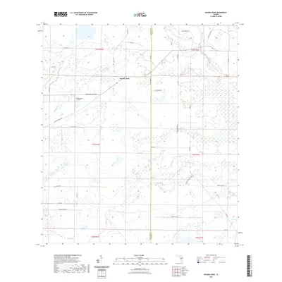
2021 Map of Myakka Head
USGS Topo · Published 2021About this map
Myakka Head serves as the primary settlement hub in this interior region of Manatee County, where the upper reaches of the Myakka River snake through a landscape defined by significant wetland systems. The drainage patterns of the area are complex, featuring numerous named tributaries like Wingate Cr and Elder Branch, alongside notable still-water features such as Goose Pond and Duck Pond. Transportation across this prairie-like terrain is anchored by the intersection of Bradenton-Arcadia Rd and Myakka-Wauchula Rd, which connect the rural interior to larger coastal hubs. Aviation presence is noted at the Myakka Head Airport, while local agriculture and land use are evidenced by a grid of named rural routes, including Juel Gill Rd and Grainger Farms Rd, which navigate around low-lying areas like the Hog Town Slough.
Find a feature on this map
51 named features on this map. Tap any name to fly to it.
Don’t see what you’re looking for? This feature index may not catch every label — zoom into the map to look around manually.
Map Details
Editions of this 2021 Myakka Head Map
This is the sole edition of this map. No revisions or reprints were ever made.
Other maps of this area

1955 · Ft. Green
USGS Topo · 1:24,000

1956 · Ona
USGS Topo · 1:24,000

1956 · Myakka City
USGS Topo · 1:24,000

1956 · Edgeville
USGS Topo · 1:24,000

1956 · Myakka City NW
USGS Topo · 1:24,000

1956 · Myakka Head
USGS Topo · 1:24,000

1956 · Limestone
USGS Topo · 1:24,000

1956 · Duette
USGS Topo · 1:24,000

1956 · Keentown
USGS Topo · 1:24,000

1956 · Tampa
USGS Topo · 1:250,000