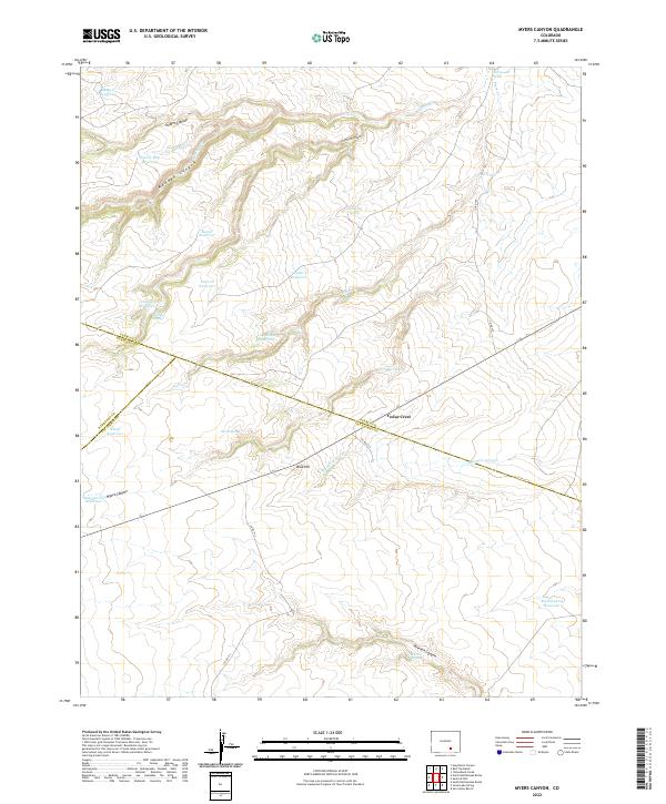
2022 Map of Myers Canyon
USGS Topo · Published 2022About this map
The high plains and rugged canyons of Southern Colorado meet at a complex tri-county junction in this modern U.S. Geological Survey study. The landscape is defined by the convergence of Pueblo, Huerfano, and Las Animas counties, centered near the settlement of Cedar Crest. Water management is the primary human imprint on this arid terrain, evidenced by a dense network of catchments including Mayer Reservoir, Baxter Reservoir, and Federal Reservoir.
Find a feature on this map
39 named features on this map. Tap any name to fly to it.
Don’t see what you’re looking for? This feature index may not catch every label — zoom into the map to look around manually.
Map Details
Editions of this 2022 Myers Canyon Map
This is the sole edition of this map. No revisions or reprints were ever made.
Other maps of this area

1891 · Apishapa
USGS Topo · 1:125,000

1893 · Apishapa
USGS Topo · 1:125,000

1897 · Apishapa
USGS Topo · 1:125,000

1954 · Trinidad
USGS Topo · 1:250,000

1955 · Trinidad
USGS Topo · 1:250,000

1958 · Trinidad
USGS Topo · 1:250,000

1959 · Trinidad
USGS Topo · 1:250,000
1970 · Hog Ranch Canyon
USGS Topo · 1:24,000
1970 · Red Top Ranch
USGS Topo · 1:24,000
1970 · Yellowbank Creek
USGS Topo · 1:24,000