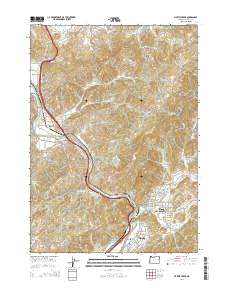
2014 Map of Myrtle Creek
USGS Topo · Published 2014About this map
The South Umpqua River snakes through this portion of Douglas County, carving a valley that has long served as a primary transportation corridor. In this 2014 representation, the city of Myrtle Creek is the central hub, situated where N Myrtle Cr and S Myrtle Cr converge with the river. To the south, the community of Tri-City and the smaller enclave of Missouri Bottom demonstrate the continued residential and commercial density along the riverbanks. The map documents an industrial legacy at the Engles and Worth Log Pond, a clear marker of the region's timber-related economy.
Find a feature on this map
78 named features on this map. Tap any name to fly to it.
Don’t see what you’re looking for? This feature index may not catch every label — zoom into the map to look around manually.
Map Details
Editions of this 2014 Myrtle Creek Map
This is the sole edition of this map. No revisions or reprints were ever made.
Other maps of this area

1897 · Roseburg
USGS Topo · 1:125,000

1900 · Roseburg
USGS Topo · 1:125,000

1904 · Riddle
USGS Topo · 1:125,000

1954 · Dixonville
USGS Topo · 1:62,500

1954 · Days Creek
USGS Topo · 1:62,500

1954 · Canyonville
USGS Topo · 1:62,500

1955 · Roseburg
USGS Topo · 1:62,500

1955 · Medford
USGS Topo · 1:250,000

1957 · Medford
USGS Topo · 1:250,000

1958 · Medford
USGS Topo · 1:250,000