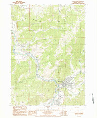
1987 Map of Myrtle Creek
USGS Topo · Published 1987About this map
South Umpqua River frontage and the confluence of its branching tributaries define the valley landscape in this Douglas County region during the late 1980s. The town of Myrtle Creek serves as the central hub, situated where North Myrtle Creek and South Myrtle Creek meet the main river. A network of heavy industry and utility infrastructure is evident, including several Quarry sites, a Sanitary Transfer Station, and a prominent Pipeline crossing. Local history is anchored by smaller settlements such as Ruckles, Dole, and Weaver, while the surrounding terrain is marked by Roberts Mountain and Round Prairie. The presence of multiple Borrow Pits and Gravel Pits along the riverbanks suggests active resource extraction and road maintenance in the area during this era, supporting the growing community and its essential services like the local Hospital and Cemeteries.
Find a feature on this map
32 named features on this map. Tap any name to fly to it.
Don’t see what you’re looking for? This feature index may not catch every label — zoom into the map to look around manually.
Map Details
Editions of this 1987 Myrtle Creek Map
This is the sole edition of this map. No revisions or reprints were ever made.
Other maps of this area

1897 · Roseburg
USGS Topo · 1:125,000

1900 · Roseburg
USGS Topo · 1:125,000

1904 · Riddle
USGS Topo · 1:125,000

1954 · Dixonville
USGS Topo · 1:62,500

1954 · Days Creek
USGS Topo · 1:62,500

1954 · Canyonville
USGS Topo · 1:62,500

1955 · Roseburg
USGS Topo · 1:62,500

1955 · Medford
USGS Topo · 1:250,000

1957 · Medford
USGS Topo · 1:250,000

1958 · Medford
USGS Topo · 1:250,000